In the dark early hours of December 4, 2008, I rode down the Pacific Coast Highway through a black void of ocean and sky. A few pairs of headlights glared toward me, and the ferris wheel at Santa Monica Pier was outlined in shifting circles and lines of colored light. The air was chilly, but I was warmly dressed, and excited to be heading for the desert.
Riding east on I-10, keeping a semi-legal pace in the outside lane, I was hoping to slip through the entire width of Los Angeles before the morning gridlock. The sky began to brighten around the downtown towers, and lines of traffic were building to the east, but luck favored my journey. I kept moving steadily, out past San Bernardino and the San Gorgonio Pass to Palm Springs. Then at last I reached open highway, climbing the long grade up to Chiriaco Summit, and turning off into Joshua Tree National Park by about 8:00.
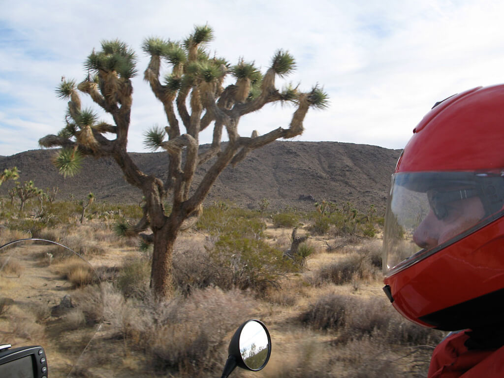
There the real journey began—the part that made that long freeway drone worthwhile. I stopped at the Cottonwood Spring ranger station and paid my fee (and collected the passport stamp in my journal), then cruised along the park’s narrow, winding roads, with hardly any other vehicles. The sky was pale blue now, mottled with white, and the high desert air remained cool. I passed the tumbled formations of huge, rounded boulders spread among the midwinter desert vegetation in pale shades of brown, and the namesake Joshua trees. They grow only in certain areas of the Mojave Desert, north of I-10, where the elevation rises above 2,000 feet, and not at all in the lower Colorado Desert, south of I-10. Coincidentally, the freeway pretty much traces the border between the high and low desert. Some of the Joshua trees are thought to be more than a thousand years old, and a few groves reach into Arizona, Nevada, and Utah. (The Mormons named the trees, as I have noted before, after the biblical prophet raising his arms to beckon the Saints to the Promised Land. Wild.)
For forty miles I cruised through the rocks, Joshua trees, fuzzy cholla and prickly-pear cactus, and tall, spindly ocotillo. Leaving the park at Twentynine Palms, I continued north on the road to the ghost town of Amboy, and Roy’s Motel, which appeared in Ghost Rider. In fact, unknown to most people, Amboy also appears on the booklet cover of the Snakes and Arrows CD, and lately, on the new concert DVD, plus at the beginning of the “What’s That Smell?” film that played before “Far Cry” during our concerts this past summer. I watched it every night from my “waiting-chair” behind Geddy’s ampline (er, rotisseries), before the second set, and it always gave me a smile.
Back in 2006, when Hugh Syme and I were trading ideas for that Snakes and Arrows cover, we discussed a surreal desert highway scene. As a reference, I sent him one of my Ghost Rider photographs, taken on a stretch of old Route 66, looking west toward the cluster of crumbling buildings at Amboy, with the unmistakable Amboy Crater in the distance. Hugh ended up “building” the scene on that original photo, which had been taken in 1998 (as a slide, in those days). Like the Monument Valley ten-years-apart photo that appeared in a story earlier this year, “South by Southwest,” I decided to pause for a ten-year anniversary shot of Route 66 and Amboy.
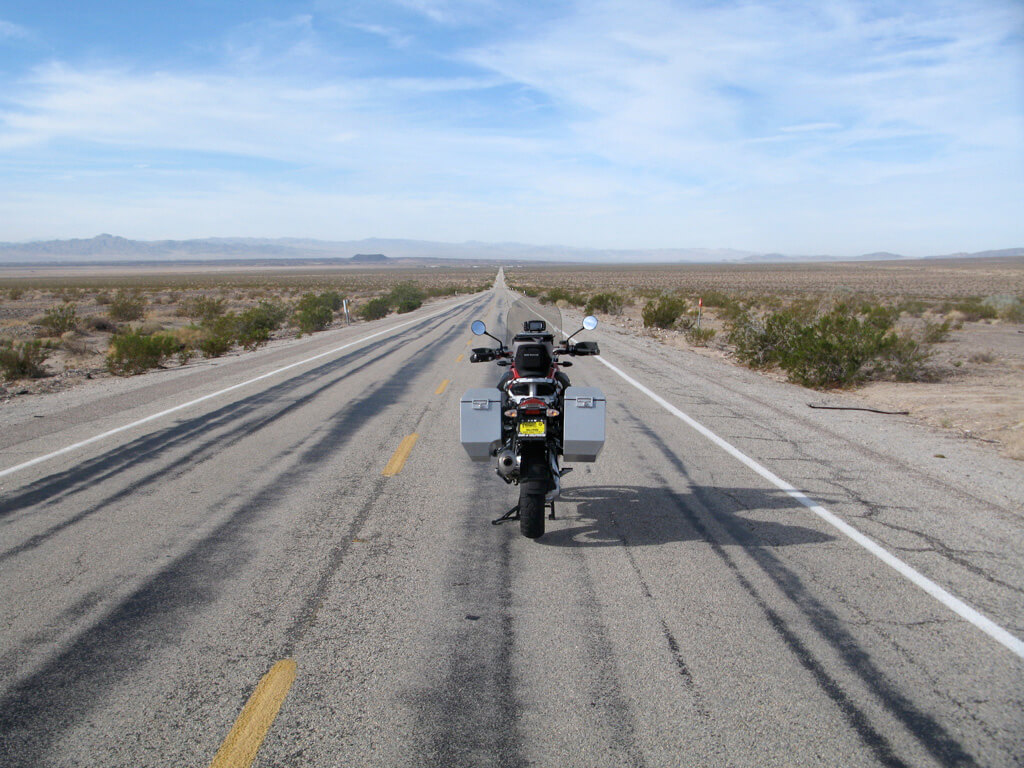
The old Ghost Rider bike from the original photo, a 1996 R1100GS long retired after 100,000 miles of sterling service, is now in the Motorcycle Hall of Fame Museum near Columbus, along with my R30 drumset.
After a few miles of Route 66, I turned north on the Kelbaker Road (it took me years to figure out that the name is derived from the simple fact that the road runs through Kelso and Baker), between wide vistas of brown, wrinkled mountains and speckled vegetation of creosote and winter-brown grassy clumps. The Mojave Desert gives a peerless feeling of space, openness, emptiness, and peace. On roads like that, I ride along feeling no sense of urgency, danger, or stress. Just cruising and looking around. You know—happy.
In the tiny settlement of Shoshone, I stopped at the worthy Crowbar restaurant for lunch (they serve soft drinks in Mason jars, which is quaint and original, and they fry up a fine burger). There were only two other diners, a corpulent couple raving about their milkshakes. After lunch, I filled up with gas at the station across the way, then headed off on a road I’d never traveled. My favorite.
Looking over the map the previous day at home, planning my route to Death Valley and browsing for anything new I might explore (always trying to find at least one new road), I noticed a dot just over the Nevada line called Devils Hole. (Note the lack of apostrophe—almost no official American place names have them, I’ve noticed, even if it’s Browns Mill or Toms River. Apparently the Board on Geographic Names of the United States Government—yes, there is such a thing—hates apostrophes. According to Wikipedia, only five names of natural features in the U.S. are officially spelled with an apostrophe, one example being Martha’s Vineyard).
The site was labeled as part of Death Valley National Park, yet it seemed to be inside Ash Meadows Wildlife Preserve, which was about ten miles east of the park’s borders. Curious. Best of all, a couple of high-desert roads I had never ridden would take me there, so I thought, “Yes—go to Devils Hole.”
From Shoshone, I set off to the east, crossing into Nevada, then at Pahrump, I looped back to the west. The road to Devils Hole was indicated on the map by a dotted line, meaning unpaved, and I thought the turnoff would be marked by a sign, but it wasn’t—in fact, the place was pretty well hidden. The state map brought me to the Ash Meadows Wildlife Refuge, then a handout at an information sign showed me the network of gravel roads leaving to Devils Hole. Still there were no signs on the unnamed tracks, so I tried the GPS. Under local “Points of Interest,” it listed Death Valley National Monument, though it’s been a National Park since 1994. Sometimes the most modern information is the least up-to-date—but it helped.
Far from anywhere, in a particularly bleak region of gravelly desert, sparse brown vegetation, and barren rocks, I spotted a chain-link enclosure, and a small wooden sign reading “Devils Hole.”
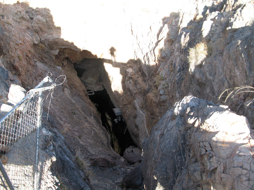
For scale, that’s my shadow in the upper middle, standing on the observation platform, looking downward through the fence. That little patch of water at the bottom of the rocky gash is home to the Devils Hole pupfish—its only home in the world (hence the national park designation for this isolated spot, to protect it), though a few have now been transferred to other places for safety.
The waterhole is a remnant of the ancient lakes that once covered this region, the basin and range province—and like a desert island in reverse, Devils Hole is a spot of water surrounded by an extremely arid land. The pupfish, iridescent blue and less than an inch long, have been marooned there for something like 12,000 years, when the massive lakes that once flooded the Great Basin faded away. The few hundred remaining pupfish live as deep as eighty feet down, but feed and breed on one small, shallow patch of algae. Because of this, the water level is critical to their survival, and apart from the national park designation, a unique Supreme Court decision in 1976 protected the local water table from overpumping, to preserve the level at Devils Hole. (In the old days, it was called Miner’s Bathtub, because the water is a steady 86°, and was easily reached before the chain-link fence was installed).
Scuba divers have explored the cave to depths of 300 feet, and still didn’t find the bottom (two divers were lost and never recovered). From the observation platform, I couldn’t see the little pupsters, of course, but I was thinking about those unlikely survivors after my visit.
So often books and travels coincide for me in a remarkable serendipity, and around the time of this Death Valley getaway I happened to be reading The Song of the Dodo, by David Quammen (sent to me as a gift during the tour—thank you “Norde”). The theme of the book was the biogeography of islands, and the razor’s edge balancing point of survival for every island species. By extension, the fragmentation of habitat in the modern world threatens the continued existence of uncountable species in a similar way: even if we save a bit of rainforest here, a piece of desert there, it’s just a fragile island, and won’t be enough.
(Cheerful reading, no, but nonetheless fascinating to a nature lover. As I’ve noticed lately with a few good non-fiction books, the key is that the writer travels to—and takes the reader to—the places he’s writing about.)
But in context of the pupfish, I was thinking that Nature also changes in ways that can seem cruel and arbitrary, and leaves behind “islands” of species that may or not survive. Over millions of years, the great “extinction events” have killed off ninety-nine percent of species that ever lived, making the odds already long, as Stephen Jay Gould described in Wonderful Life. Even the most recent period of glaciation, ending around 12,000 years ago, left behind islands of life stranded in much-reduced environments, in higher, cooler elevations, say, or like the pupfish in their cave in the desert.
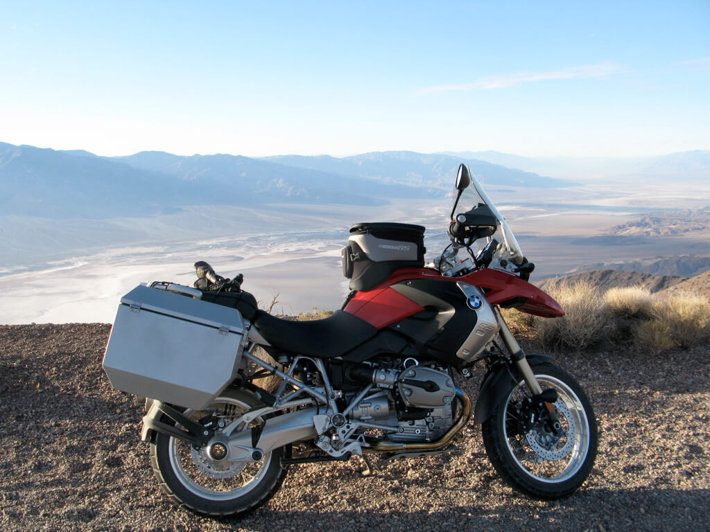
Here I will resort to the old bike-parked-in-front-of-landscape shot.
Because what a bike—and what a landscape.
The motorcycle is a new BMW R1200GS, and this was our first adventure together. Strangely, BMW did not offer the bike in red this year (are they insane?), so I had to have it painted—because all my motorcycles have been red. I’ve never been comfortable driving a red car, you understand, but it just seems right for a motorcycle. And I didn’t want to settle for a silver, blue, or (gasp!) yellowish-orange one. After having the paint done, and the accessories installed—Jesse luggage cases, Motolights on the front for extra conspicuity, GPS (Dingus III), power for the radar detector—I finally brought the new bike home in late November. I stood looking at it in my garage for a while, and wondered, “Where will we go together?”
My two previous 1200GSes had certainly carried me far. For the Snakes and Arrows tour in 2007 and 2008, my two “working bikes” had been a 2004 1200GS, with over 70,000 kilometers (42,000 miles), and a 2007 model, with over 60,000 kilometers (36,000 miles). Both bikes had been purchased in Canada, and although the ’04 had later been registered in California, it would be difficult ever to sell or trade the bike there, given that state’s strict regulations. During the tour, one of our crew members, Kevin, said he wanted to buy my older bike, and because he lived in Calgary, there was no problem with its Canadian origin. I agreed to sell the ’04 to him, then planned to buy a new one in California, keep the ’07 in Quebec, and everything would be kosher.
So that’s the bike. As for the landscape, it is Death Valley, from Dante’s View (no apostrophe on the park map—but this time I think it looks funny without it), at 5,746 feet, looking down to Badwater Basin, at -282 feet. From Devils Hole I had continued west about thirty miles toward the main part of the national park, which surrounds the valley itelf, and when I saw the sign for Dante’s View, I immediately turned off on that isolated road to its high overlook. (Those two names are good examples of the dark humor that shades several of the place names in Death Valley, like the Funeral Mountains, Coffin Peak, Hells Gate, Devils Cornfield, and Devils Golf Course.) The road was a challenging combination of tight, technical curves on narrow pavement, and in early December, I had it to myself, as I did the cold viewpoint at the top.
The Dante’s View road had been closed for some years, after a devastating flash flood in August 2004 that swept away several roads—not to mention cars and buildings—and I had been told it would likely never reopen. Away on tour that year, I hadn’t been making any local road trips, but when I visited Death Valley the following spring, I saw photographs at the Furnace Creek General Store that showed the Inn completely enisled by a flow of water spilling out of the canyon behind it. That visit was in April 2005, and while I was there I hiked to the top of Wildrose Peak, at 9,046 feet. From the summit I looked down at the Furnace Creek Inn, pretty much at sea level, through my binoculars, and saw a brand new alluvial fan, or bajada—a field of debris washed down by the flood—spreading all around it and across the valley floor like a chocolate-brown apron. Geology in action.
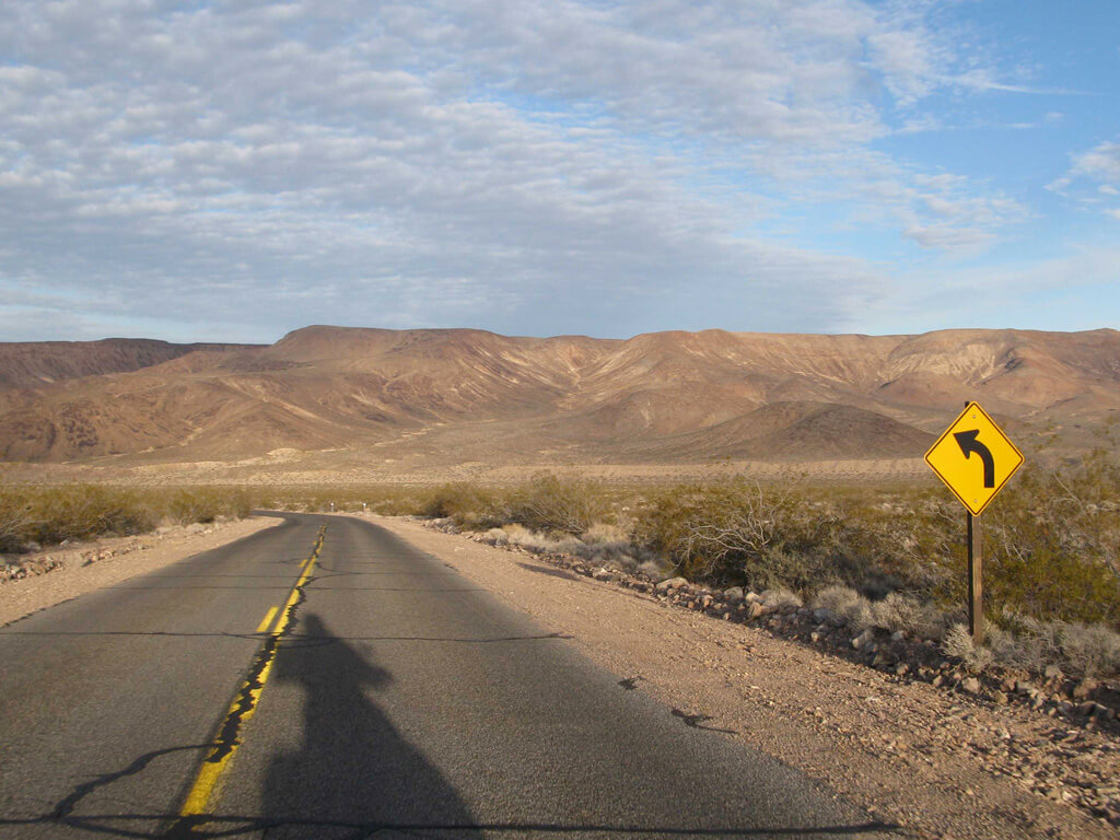
And biology, too—riding back that evening in April, 2005, I noticed there were already tufts of vegetation in the tumbled debris, after only five months. Desert life is necessarily opportunistic and hardy, and some desert seeds are only germinated by the action of grinding stones in a flash flood. Thus they have a better chance of sprouting with the necessary moisture for survival.
This time, in December, 2008, it was mid-afternoon when I came riding down from Dante’s View, and I rode into the valley at Furnace Creek and stopped at the Visitor Center for a passport stamp and hiking information. Alas, it was a moment symptomatic of many bureaucratic evils in our times: I asked the lady in the ranger uniform about hiking advice, and she confessed she was “only a fee taker”—she didn’t know anything about trail conditions, and there was no ranger on duty. That’s just wrong. (Tax money is rarely better spent than on the national parks, but apparently not enough taxpayers, or their elected representatives, agree.)
As I rode across the valley floor around four o’clock, ready to check in at the Furnace Creek Inn, the sun was already sinking behind the Panamint Range. A soft light lay across the alluvial fans, the even, gradual slopes at the base of the mountains, between flat ground and the folds of dark rock. In the glimmer along the peaks, I saw a dusting of white around the highest summit, Telescope Peak, where I hoped to hike the following day.

Telescope Peak was an important place in Ghost Rider—and in my life, really. In October 1999, when I had been rambling aimlessly around the West for the better part of a year, trying to find some way to face the world again, I hiked to that 11,049-foot summit. The next day, I rode on to Los Angeles, where I met Carrie, and my whole life changed completely (and needless to say, positively). An irresistible metaphor seemed to arise there—that I had climbed to the highest point in Death Valley from the lowest, then descended to travel onward and find Life again. In the book Ghost Rider I had used Telescope Peak as an important symbol, and had written some lyrics called “Telescope Peak,” too, around the refrain of “the last lonely day.”
Those lyrics hadn’t found a musical home with my collaborators, Alex and Geddy, during the songwriting sessions for our Vapor Trails album in 2001, but fair enough—those guys shared enough of my grief, in life and in art. In any case, the best lines from “Telescope Peak” were recycled into other songs, like “Ghost Rider” and “How It Is,” so nothing was lost.
Listening to some of that music just before setting out on this journey, as the three of us reviewed a couple of remixes of songs from Vapor Trails for an upcoming anthology, I can still sense my state then—an underlying mood of anger and confusion that comes through even in my drumming, never mind the lyrics.
I still have the anger, all right, but I think I’ve left the confusion behind.
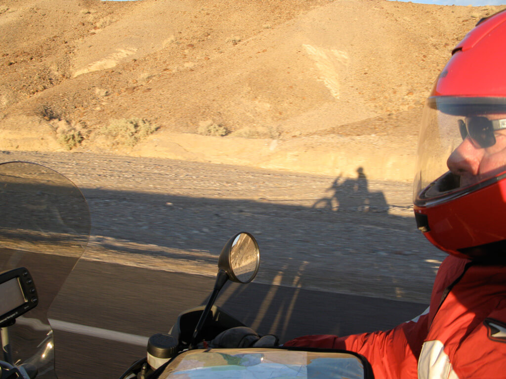
There’s my shadow riding alongside, caught in the low December sun as I rode through Death Valley. In the song “Ghost Rider,” I described my feelings on those lonely, aimless travels: “There’s a shadow on the road behind/ There’s a shadow on the road ahead.” Those shadows are still with me, alas, but at least these days I can say that they are mostly behind me, but will always remain beside me—inside me.
And, inevitably, ahead. (Taking the Tragic View.)
Early next morning I rode about sixty miles across the valley and up Emigrant Canyon Road, aiming for a hike in the Panamint Mountains. I was still thinking of going for the “big one,” Telescope Peak, as I wanted to close that circle of more than nine years ago—revisit the place that had also inspired another line in “Telescope Peak” that ended up in “Ghost Rider:” “From the lowest low to the highest high.”
All things considered, though, I decided that would be foolhardy. It was a fourteen-mile round trip, the days were short, and there was that snow. If other hikers had packed it down, it would freeze again into solid ice, and on a steep trail, it would be extremely treacherous. With the temperature falling into the 30s, and lower at night, one slip, one injured ankle, knee, or hip, and I would be in big trouble.
My rule number one of roadcraft applies to hiking, too: If something happens to me, it mustn’t be my fault.
By the time I got to Emigrant Canyon Road, I had convinced myself to go for the prudent option, Wildrose Peak. Its trailhead was on the way to the Telescope Peak trail—in fact, that mountain’s snowy pyramid would dominate my view through most of the Wildrose climb—and it was still a serious hike, starting at 7,000 feet and climbing over four miles to its 9,046-foot summit.
About thirty miles up Emigrant Canyon, as I sped along the narrow, twisty, deserted road (yahoo!), it turned to gravel, and I slowed and adjusted to the loose surface (weight on the pegs, assertive hand with the throttle, light on the rear brake). I parked in the empty gravel lot in front of the charcoal kilns, where the trail began.
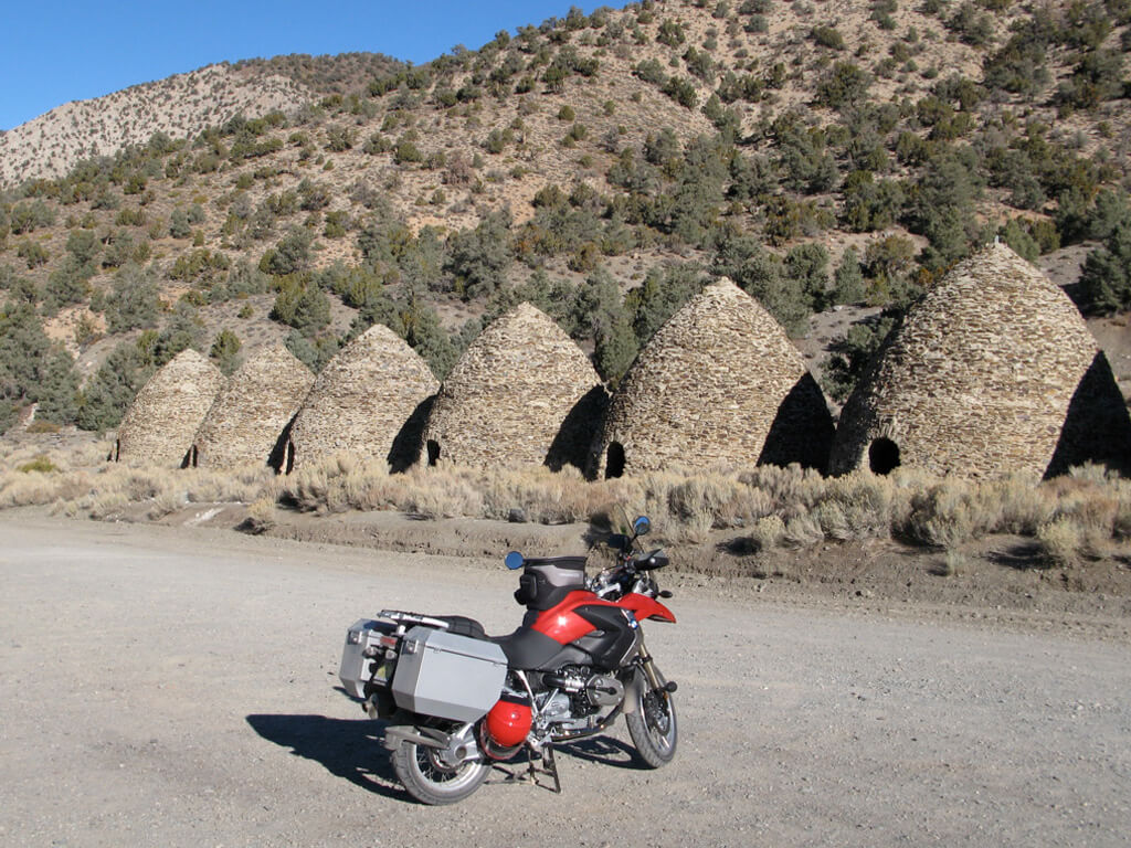
A sign explained the purpose of these beehive-shaped stone structures: they were giant ovens to render the local pinyon pine trees into charcoal for the smelters at mines in the desert below. Built in 1877, they were only used for one year before the mines were abandoned. The kilns were “designed by Swiss engineers and built by Chinese laborers,” and that got me thinking—about those Chinese laborers. What must their lives have been like? (Not fun.)
One fascinating aspect of the Death Valley area is the history. Part of that history is geological, from the huge Manly Lake that once filled the valley to the faulting and subsidence that have made it the hottest, driest, and lowest place in North America, but there is a surprising amount of human history, too. Because Death Valley is perhaps the most inhospitable region in North America, short of the Arctic, the stories are rich and endless. They begin with the Timbisha Shoshone, who still occupy a small reservation on the valley floor of perhaps a dozen families, then the wagon trains heading West and choosing an ill-advised shortcut, and the miners and prospectors living and working in what are now ghost towns: Skidoo, Rhyolite, Ballarat, Wildrose, the Eureka Mine.
I remember a TV show from my childhood called Death Valley Days, one of television’s longest running series, from 1952 to 1975 (one host was Ronald Reagan, just before he entered politics). Death Valley Days began as a radio show, from 1930 to 1945, and was sponsored by the U.S. Borax Company. The company had been harvesting borax (used for detergents, plastics, and many other industrial purposes—including, Wikipedia says, “curing snakeskins”) in Death Valley, and as the borax played out, they were looking to publicize the region for tourism. I dimly recall the commercials for “20 Mule Team Borax,” with a miniature mule team skittering comically around a kitchen floor—pretty fancy effect for 1950s TV. The screenplays for all 558 episodes of the TV series were at least based on true events, so there were some stories in Death Valley, all right.
I changed out of my leathers and into khakis and hiking boots, then shrugged into my daypack (carrying tuna sandwiches, cheese, peanut butter cups, lemonade, two bottles of water, binoculars, a pair of light gloves, my motorcycle rain jacket as an extra barrier if it got too cold, my camera, and—of course—a Swiss army knife). I headed up through the pinyon pines and junipers, the air cool and fresh, but thin already above 7,000 feet. The trail was steep, and sometimes faint, winding among roots and small, loose rocks that demanded attention to where I planted my boots. I was soon sweating, and feeling the burn in my leg muscles.
Toward the top I encountered some snowy patches, the loose scree of the trail coated in hard bluish ice. Once again, the fear of falling and injuring myself was daunting, and I tried to be careful (it doesn’t always come naturally). Sometimes I could step around the ice into the crusty snow, and kick my toes in to gain purchase and hoist myself uphill. A few times I had to grab onto a nearby bush for support, and once I smelled the most delicious perfume, piney but with a hint of vanilla and citrus (sounds like a “wine bore”). I discovered that the fragrance was coming from my hands, and looked back to see that it was a limber pine I had grabbed. I knew them as one of the characteristic high-elevation trees of the Western mountains, but I never knew they smelled so good. After that I occasionally crushed a few more branches in my hands on purpose, just to inhale that subtle perfume again.
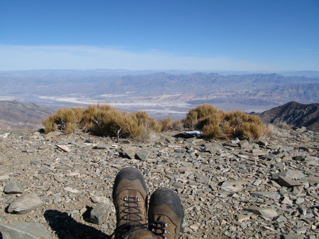
Patch of snow above left boot; and distant Furnace Creek—
and its alluvial fan—almost two miles down, above right boot
On a climb like that, my mind is always working furiously. All the way up and all the way down I was having conversations with myself, and mentally “writing” things into sentences—descriptions, reflections, ideas. My friend Kevin Anderson hikes the mountains of Colorado and dictates his novels into a recorder while he walks. Obviously that needs a serious focus and discipline, to shape descriptions and dialogue into the story he’s building. My thoughts are more random, and I simply imagine how I might put them into words. I often do that on the motorcycle, too, and I figure in that three-day journey I “wrote” about 10,000 words. Now I just have to work until I take away those quotation marks . . .
That day I was giving myself a “talking to” about something, and resolving to kick myself out of my usual shyness, my usual comfort zone. The previous night, as I walked from my room at the Furnace Creek Inn to the main building for dinner, I saw two BMW GSes like mine (one red) in the parking lot. They had Ontario plates, and I thought, “Hmm.”
I walked into the lobby a few minutes before my 7:15 reservation, and had a look through the gift shop, and at some of the old photographs on the lobby wall. From the corner of my eye, I saw two guys hesitantly moving my way, and I thought, “Hmm.”
One of them called out my name, and I gently corrected his mispronunciation, then nodded, “Yes,” and offered a small (careful) smile. They were fortyish, I would say, quietly friendly and polite (Canadian, after all—we’re famous for saying thank you to ATMs), and introduced themselves, shaking my hand. One of them said, “We’ve read your book!” and I guess he meant Ghost Rider, where I talked so much about Death Valley. Though embarrassed as always by attention from strangers, I have to admit I was secretly a little pleased by this fresh kind of fame—not about hitting things with sticks, or writing mildly cryptic lyrics that people interpreted their own way (for better or worse!), but as a traveler, a travel writer. That was nice. I was still embarrassed, but it was nice.
They went off to the dining room (unusually busy for the time of year, as a marathon was being held the following morning), and I saw them across the room as the host led me to my table. They left me alone to scribble in my journal, while I enjoyed a fine dinner of tortilla soup, lamb with couscous, ice cream with cherries, and pinot noir and coffee. On my way out I stopped by the two riders’ table, smiled and said, “Have a good ride!” They returned the sentiment, and that was it.
But when I thought about it later, I wanted to know their story. For one thing, how did they get their bikes from frozen Ontario to Southern California in December, unless they had been traveling a while—like I had done in ’98 and ’99? (“The Wilderness Years” just occurred to me as a title for that time. I see it was the title of a movie about Winston Churchill, and his famous quote also fits well: “When you’re going through hell, keep going.”)
Where did they come from? What did they do for a living? What about their families?
So as I hiked up the steep trail, I decided I wanted to make myself do something bold. I promised myself that if those two guys were still at the Inn when I got back that afternoon, I would invite them to join me for dinner. That was about the most unlikely thing I—or anyone who knows me—could imagine me doing.
Hiking down to the trailhead, I felt weary but contented. Changing back into riding clothes, I lifted my right leg over the bike’s high saddle and heard myself utter an involuntary “ow.” But it was a “good hurt.”
The bike’s thermometer read 35°, which surprised me, as it didn’t feel that chilly. (“It’s a dry cold.”) The air must have been even colder at the top, 2,000 feet higher, but I had been comfortable enough while eating my lunch and reclining on a pile of sharp stones—which also felt remarkably comfortable after the hard climb.
I rode back across the valley, admiring the graceful shadows on the dunes and the golden light on the furrowed brown mountains. As I gradually descended from 7,000 feet to sea level (and below), I watched—and felt—the temperature climb to 77°. Back at the Inn, I kept an eye out for those two bikes and their riders, but they were gone. I never got to put my bold resolution to the test.
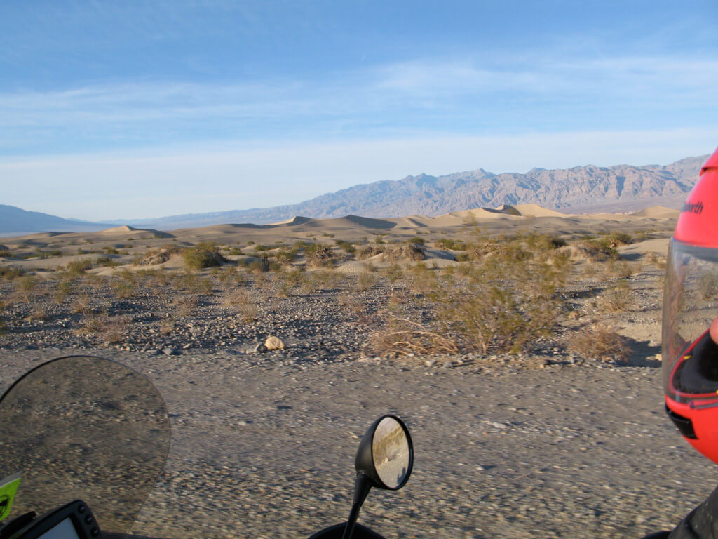
But still, I wondered about those two Canadian motorcyclists on their adventure-touring bikes—wondering if it was their first visit to Death Valley, and what they thought of it. After all, it wasn’t the kind of place everybody would appreciate. (In a story for Motorcyclist magazine, I once wrote about a certain humble motel, and on a subsequent visit, the new owner told me people had been showing up to stay there because of me—even wanting the same cabins Michael and I had stayed in. Although the place was perfectly adequate, and even charming for me, I felt a little concerned that other people might find it less so—and blame me!)
I would certainly never forget my own first visit to Death Valley, in the fall of 1996. Brutus and I had spent the day rambling around big, empty Nevada, then crossed into California through the fantastic Westgard Pass. We had made a late start because of a snowstorm in Tahoe City, forcing us to wait until the snow softened up a little so we could “tiptoe” over the pass to Carson City. Thus by the time we reached Lone Pine, the turnoff for Death Valley, it was already getting dark. As we fueled up and headed east on winding Highway 190 into the jagged mountains, a full moon rose ahead, lighting the stage for one of the greatest rides of my life.
Brutus told me later he could see I was “getting into that groove,” speeding ahead into the tight curves and pouring on the steam. Sometimes that happens to me late in a long day—I feel myself ease into that perfect focus, my whole being concentrated on reading the road ahead, and handling the motorcycle as smoothly, and rapidly, as possible (with some regard for consequences, of course). Brutus said he saw me start to pull away from him, and he just “let me go,” shaking his head and riding his own pace.
When we emerged from the mountains, riding together in formation again, I was elevated by the adrenaline generated by that on-the-edge riding, and exalted by the radiant light of that full moon. It flooded Death Valley, shining silver off the mineral lakebeds, and shadowing the dunes and clumped vegetation of the Devils Cornfield. We followed our headlights south to Furnace Creek, glad to be there, and glad to be alive.
In the morning we got up before sunrise and rode to Zabriskie Point, then sat on the hillside out of the chilly wind and watched the valley gradually bloom into light, like an old-time photograph developing in a chemical bath. Then back to the Inn for breakfast, and on to the next show.
That’s how the first visit to Death Valley was for Brutus and me, and I hope it had some of that unforgettable magic for our two fellow Canadian explorers. While I was riding to the trailhead at Wildrose, I passed the turnoff for Scotty’s Castle, and was reminded of the second time Brutus and I rode to Death Valley. We were on our way to start the second half of the Test for Echo tour in Southern California in early 1997, and we had allowed an extra day for the cross-country journey from Toronto, in case of trouble. When we didn’t have any trouble, we spent that day in Death Valley. I started adding up how much Brutus and I had seen and done that day, and it didn’t seem possible.
Traveling with Brutus was like that—I have described him before as “Mr. Carpe Diem,” and he can pack more action into a day than anybody I know. We started painfully early (of course) and rode sixty miles up to Scotty’s Castle (itself another fabulous story, literally, perhaps for another time) and took the tour. Then we stopped to look at Ubehebe Crater, and followed a long unpaved road to a place called The Racetrack (a dry lakebed where good-sized stones actually “sail” after a rain, driven across the slick surface by the wind, and leaving eerie trails in the thin layer of mud).
We backtracked a few miles to Teakettle Junction (with its solitary tree hung with numberless teakettles), and south on a very rough Hunter Mountain Road. That was a challenging thirty or forty miles of slippery dirt edging along sheer, vertical slopes until we reached pavement again, then 100 miles back to the Inn. After a fine dinner, we sat outside with coffee and cognac, the sky’s velvet blackness dominated by the fiery white triangle of Comet Hale-Bopp.
As I piece that day together in memory, I still can hardly believe it. But—that’s Brutus for you. That’s the way he rolls, and that’s the way you have to roll when you roll with him. And the habit is contagious.
The same traveling mode came into play on my three-day getaway to Death Valley, every minute and every mile packed with sights and sensations. On the ride home, I took a different route south through Panamint Valley, then skipped between some of the larger desert towns on little-known back roads. From Frazier Park, I picked up the fantastic combination of Lockwood Valley Road and Highway 33 down to Ojai, then across to the Pacific Coast Highway and home. Altogether, I motorcycled over 1000 miles, hiked eight and a half miles to Wildrose Peak and back, did some thinking, reading, and journal-writing, and mentally “wrote” a good 10,000 words. (And here are more than half of them.)
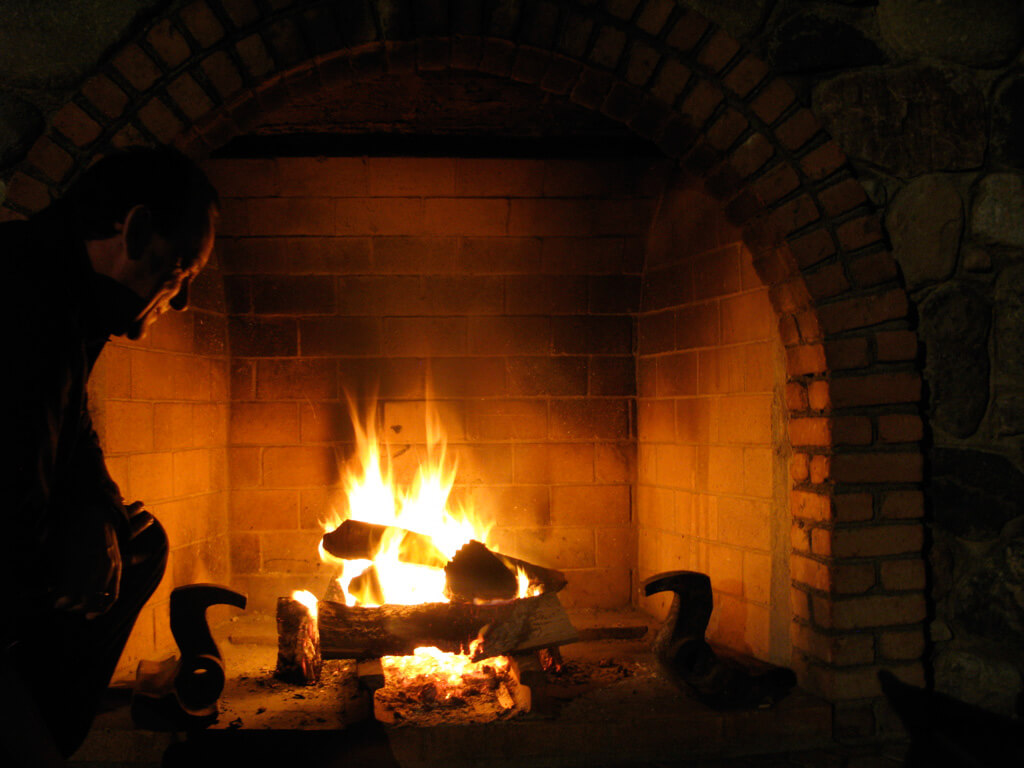
The Furnace Creek Inn has a pair of outdoor fireplaces beside its spring-fed swimming pool, and they are lighted every evening at sunset. After dinner, on a cold December night, it was a treat to go down there and throw a few logs on one of those fires. I sat and basked in the radiance and warmth, the smell of the pinyon pine logs like incense. Above, a gray plume of smoke streamed from the stone chimney and traced across the starry black sky. While looking through the day’s photos on my camera, I started messing with the self-timer, and set up a self-portrait beside the fire—laughing at the very idea.
A Christmas card from Death Valley.
